Southwest & Buzzard Point Flood Resilience Master Plan Washington, DC
Services Provided
Resilient & Sustainable Design
Green Infrastructure Planning
People Involved
Xibei Song
Award
2024 Potomac ASLA Merit Award in Analysis, Planning, and Urban Design
A neighborhood-scale study - one of the first of its kind in the U.S. - brings flood mitigation tactics to Southwest Washington, DC and Buzzard Point for future climate resilience.
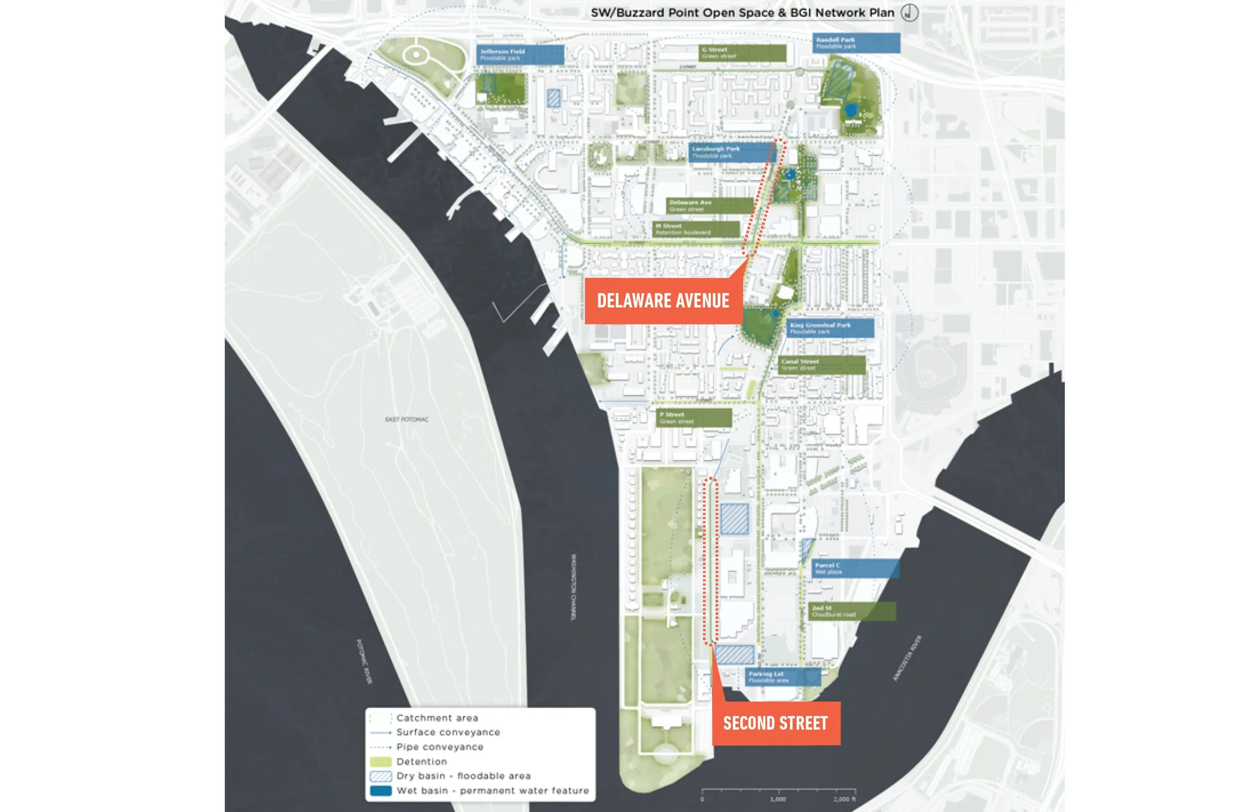
The Southwest & Buzzard Point Flood Resilience Strategy for the District of Columbia Department of Energy and Environment (DOEE) is a groundbreaking, neighborhood-scale model for how cities can adapt to climate change–driven extreme flooding. One of the first plans of its kind in the United States and the nation’s capital, the Strategy translates future stormwater projections into a replicable Blue-Green Infrastructure (BGI) network embedded within streets, parks, and the public right-of-way. Designed to accommodate storm events far beyond today’s norms, the plan reimagines infrastructure as a community asset—simultaneously increasing flood capacity, strengthening disaster resilience, and delivering everyday environmental and social benefits such as cooling, cleaner air, ecological restoration, and spaces for learning, play, and gathering. With $18 million secured for phased implementation, the Strategy establishes a scalable framework that can be applied across other DC neighborhoods and cities worldwide facing similar climate challenges.
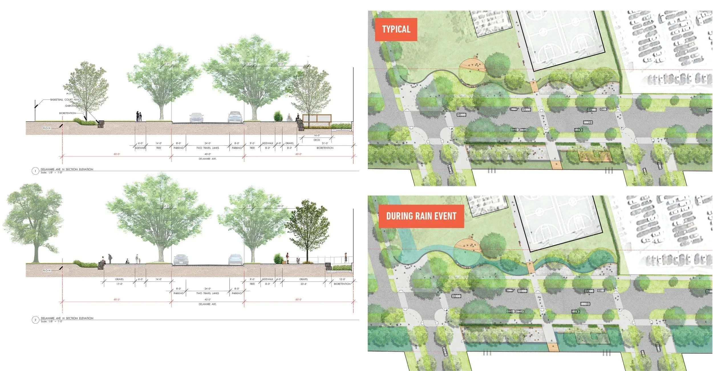
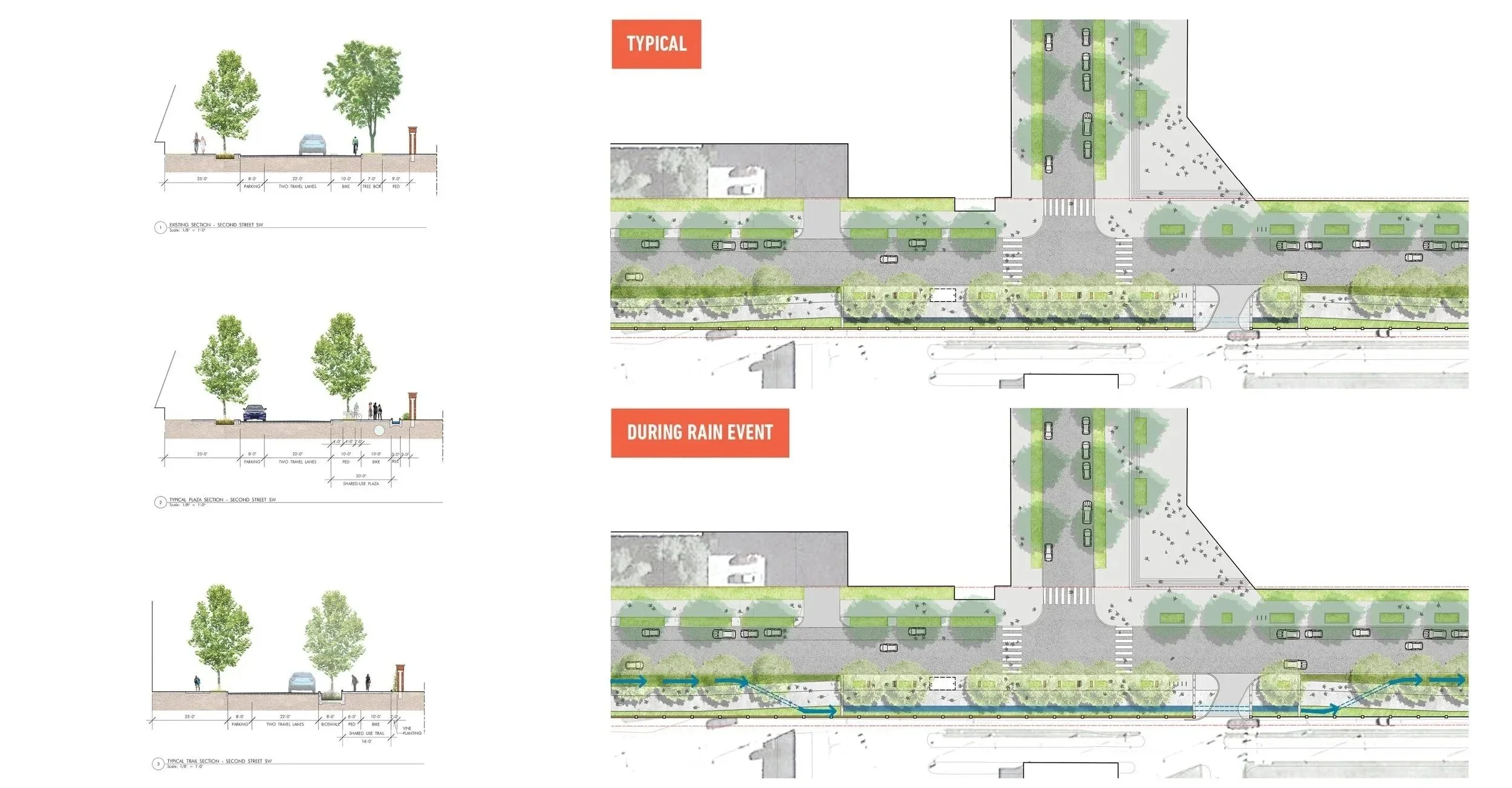
As the landscape architecture lead, MKSK partnered closely with the engineering team and DOEE to shape the form, placement, and function of BGI elements throughout the public right-of-way. MKSK designed large surface storage and conveyance bioswales capable of managing storm volumes up to five times current events, while prioritizing safety, comfort, and dual-use programming during non-emergency conditions. The team identified street and right-of-way typologies that function as both critical infrastructure and high-quality public spaces, delivering co-benefits including heat reduction, carbon sequestration, habitat creation, and enhanced neighborhood character. MKSK also supported cost estimating, phasing strategies, and public engagement, presenting design options to agencies, stakeholders, and community members to ensure the plan reflected local priorities and long-term resilience goals.
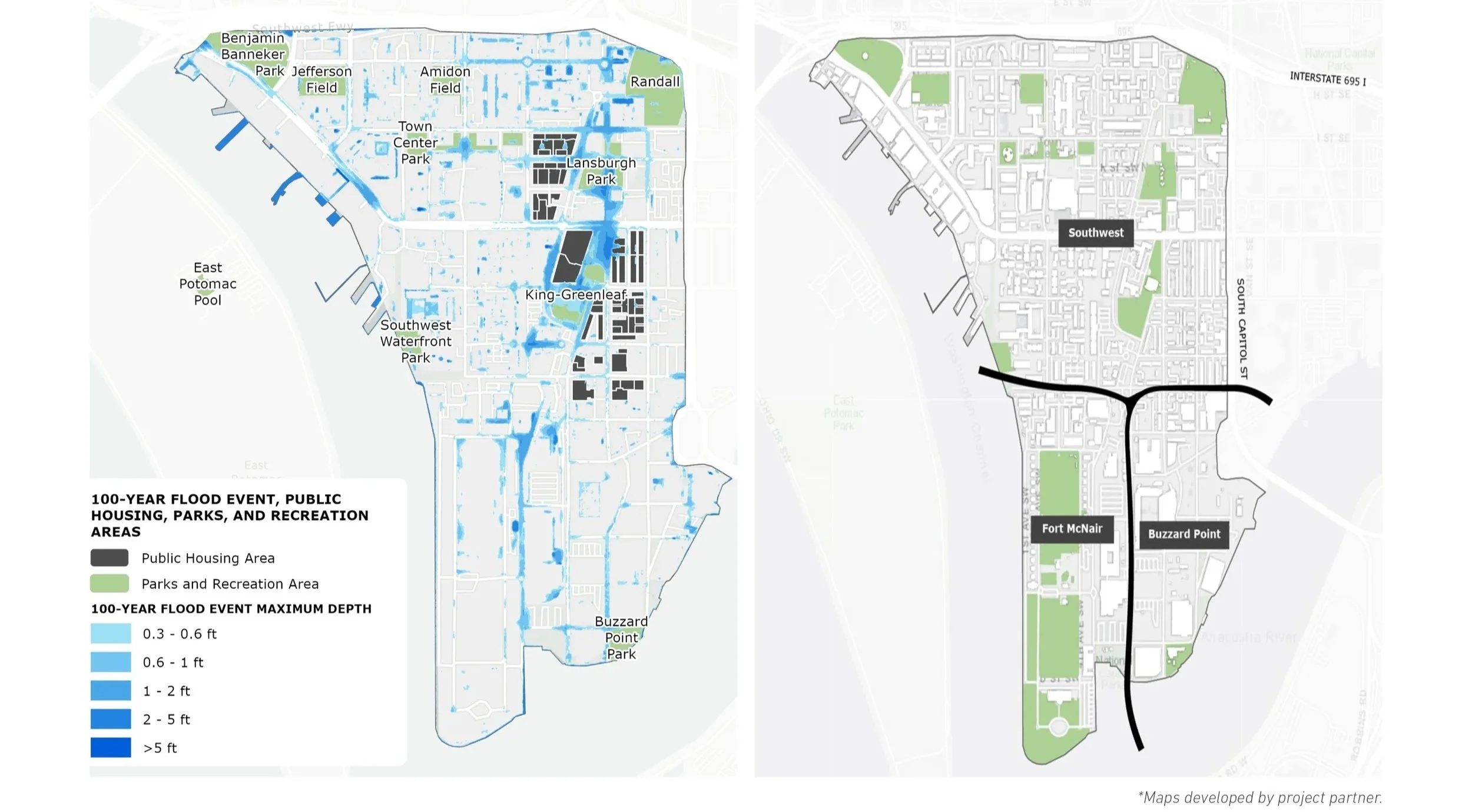
The Southwest DC neighborhood has a history of flooding. Stormwater naturally collects in the historic James Creek corridor. The goal of the plan was to create greater storage capacity at these low points for the much larger storms expected over the next fifty years.
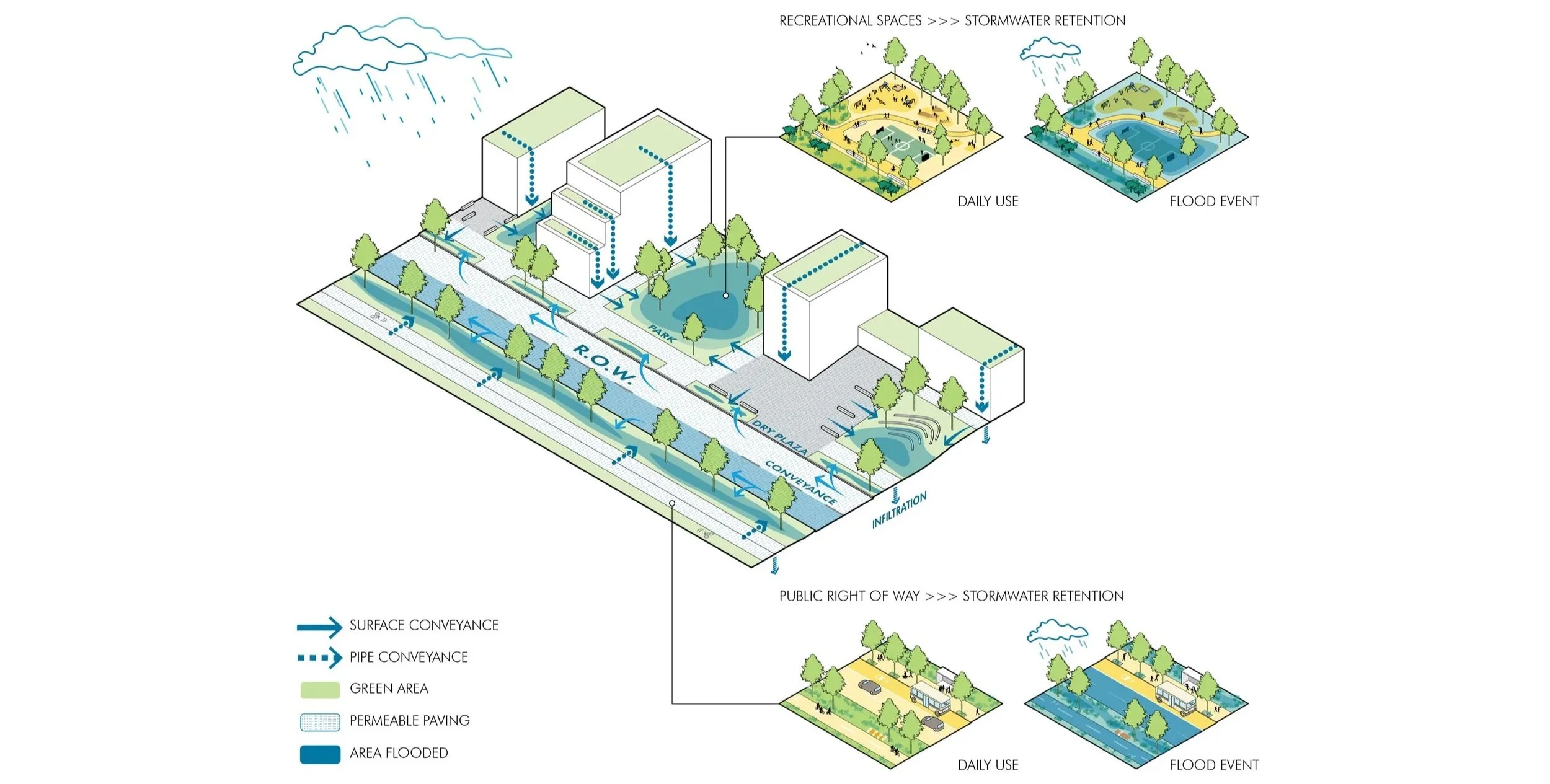
The BGI network of bioswales, retention, and conveyance road types redirect five times current storm capacity – the projected increase in storm volume – away from homes, businesses, and emergency response infrastructure into ballfields, amphitheaters, and other urban catchments.
The final plan incorporated the developed prototypes, a more completely engineered system and community/stakeholder comments.
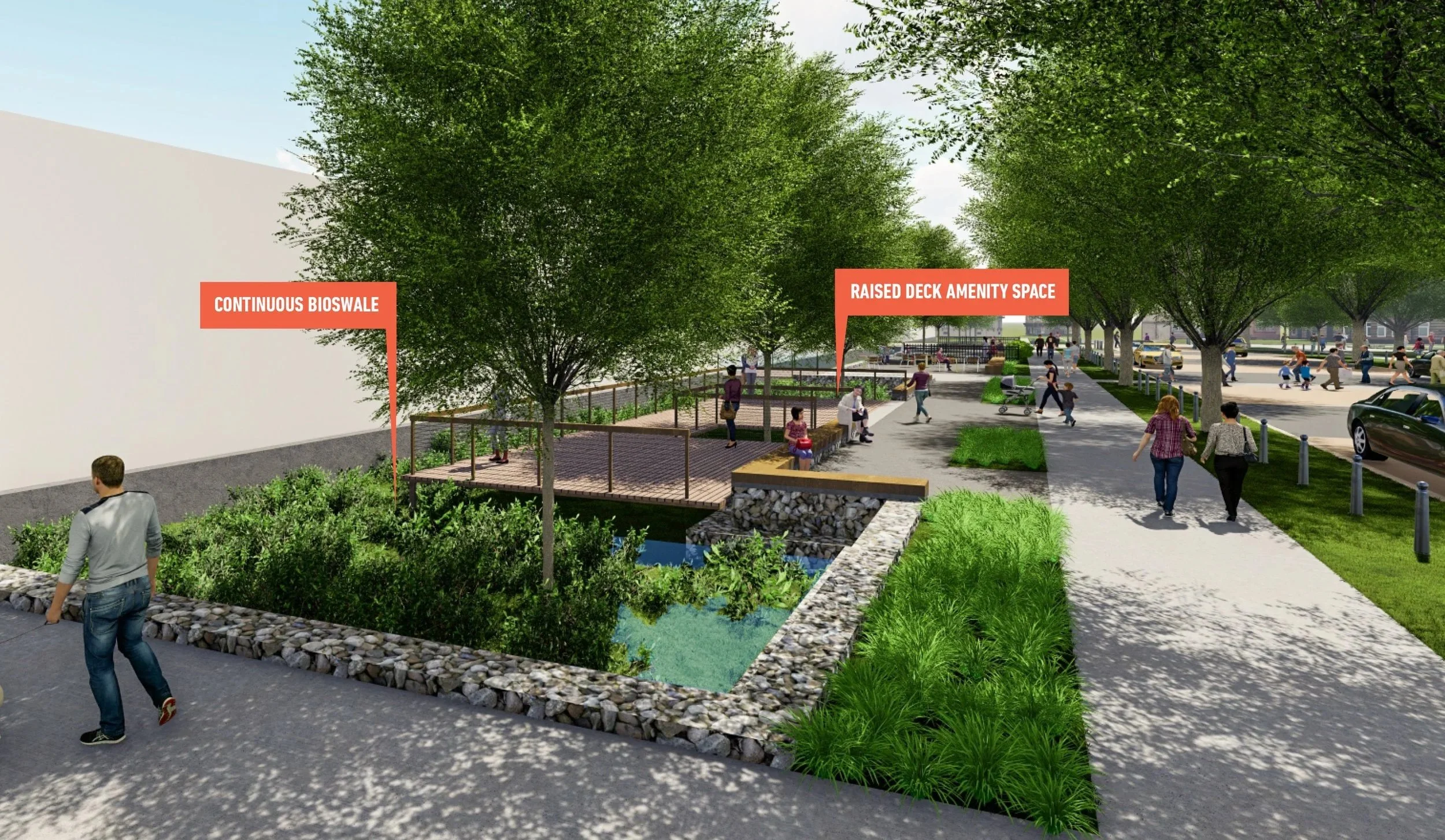
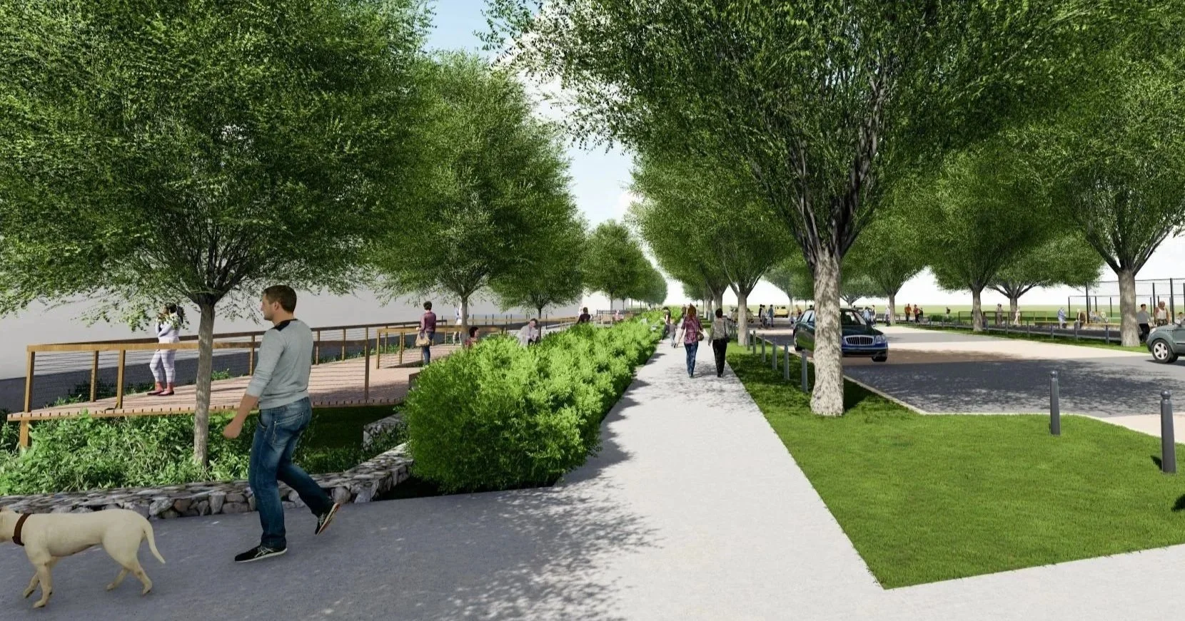
Unique Spaces for Community: To create usable public spaces that interlock with the new concave landforms, the team explored landscape types and materials not usually associated with DC public right-of-ways, such as decks and bridges.