
The Banks Riverfront District Plan Cincinnati, Ohio
Role
Urban Design / Planning / Public Realm Strategy
People Involved
Jeffrey Pongonis, Andy Knight, Tyler Clark, Tony Murry
Typology
Public Park, City Infrastructure, Master Plan
Project Timeline
2025 - Ongoing
Collaborators
Perkins&Will, HR&A, Nelson/Nygaard, Kolar Design
An urban design plan to usher in a new era for Cincinnati’s Riverfront District
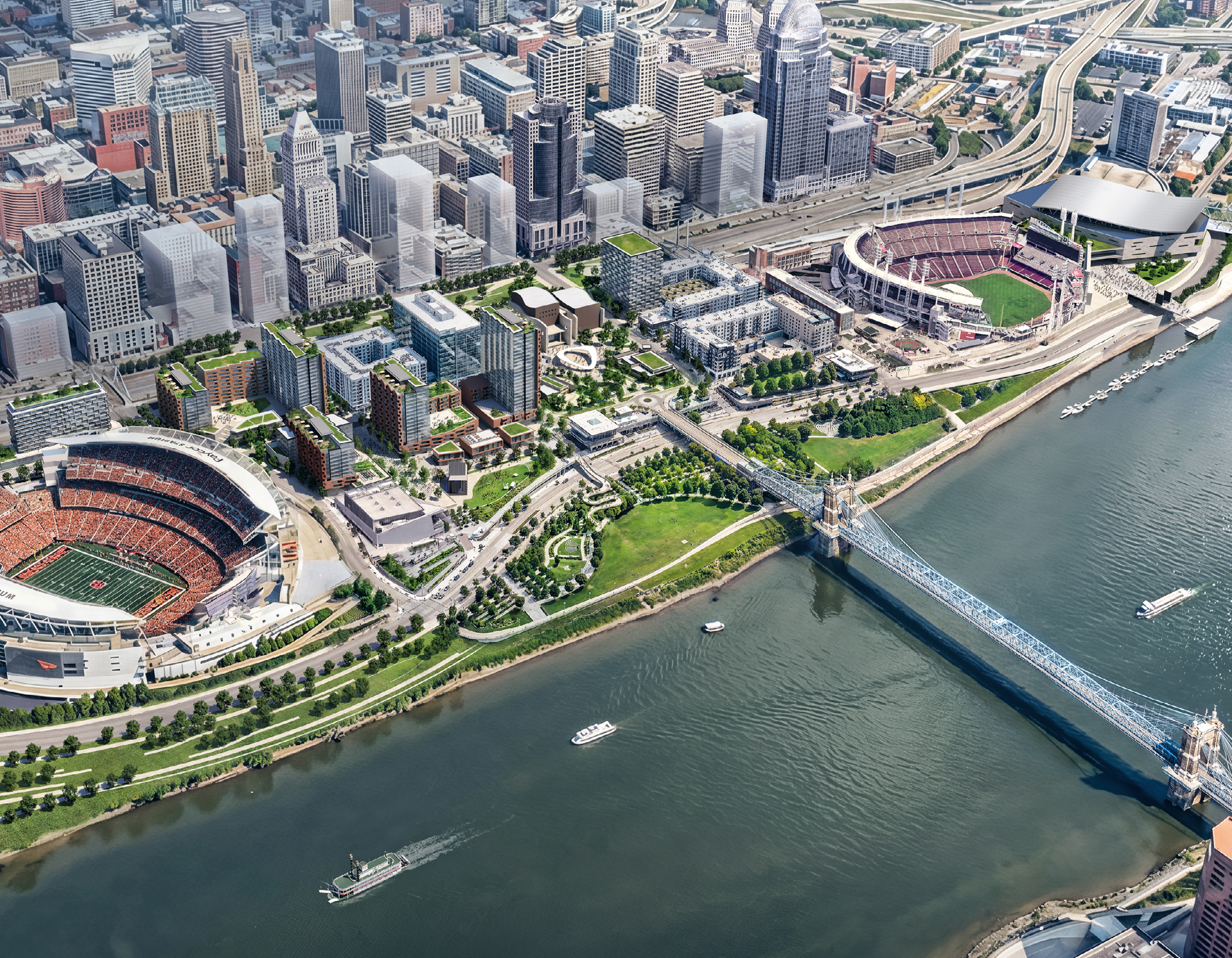
For decades, the Ohio Riverfront has shaped Cincinnati’s identity by fueling commerce, enabling connection, and even serving as a critical passageway along the Underground Railroad. Today, The Banks Riverfront District Plan represents the next chapter in an evolving city story with this vision to transform the area into a walkable entertainment and sports destination defined by a vibrant, mixed-use space designed for everyday life.
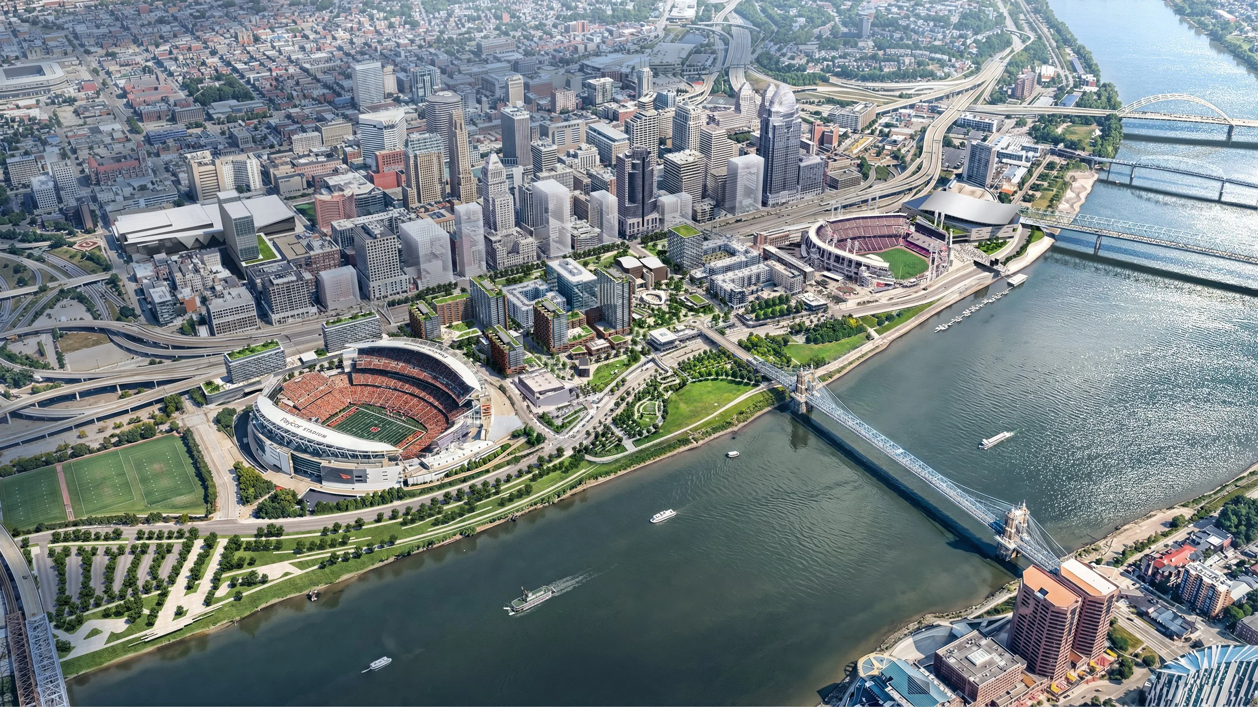
Developed in collaboration with Perkins&Will and a network of public and private-sector partners, The Banks establishes a coordinated framework for the continued development of an 18-acre site at the heart of Cincinnati’s waterfront. Cornered by Paycor Stadium, Great American Ball Park, The Andrew J. Brady Music Center, and the National Underground Railroad Freedom Center, the plan advances the long-term ambitions first outlined in the district’s 2000 master plan to create a connected urban environment where living, working, recreation, and culture can coincide.
“Great neighborhoods are built around great public spaces. At The Banks, parks, plazas, streets, and riverfront connections are more than amenities - they are the foundation of the neighborhood itself. By investing in a high-quality public realm anchored by a signature civic plaza, Cincinnati is creating a district that supports everyday life, strengthens connections to the riverfront, and provides the foundation for long-term economic vitality, private investment, and a vibrant waterfront experience.”
- Jeffrey J. Pongonis, FASLA, Principal Landscape Architect, MKSK
The Banks will help complete a cohesive 120-acre riverfront district anchored by new residential, commercial, and civic destinations. Two signature 25-story residential towers are planned to introduce more than 3,000 new residents to the neighborhood, establishing the critical mass needed to support local businesses, activate public spaces, and foster a true sense of community. Together, these investments are expected to generate approximately $800 million in public and private development while reinforcing Cincinnati's relationship with its most significant natural asset: the riverfront.
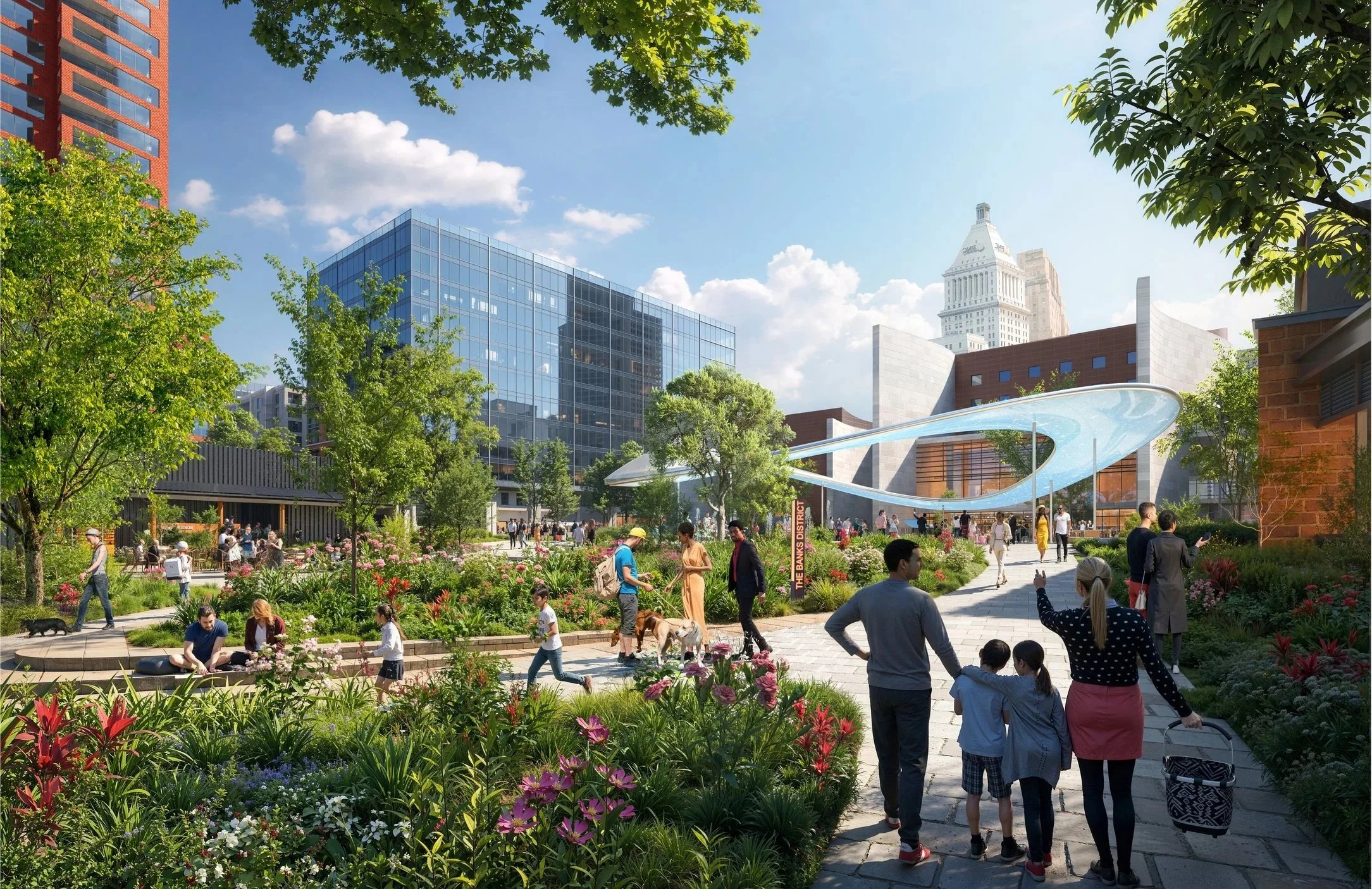
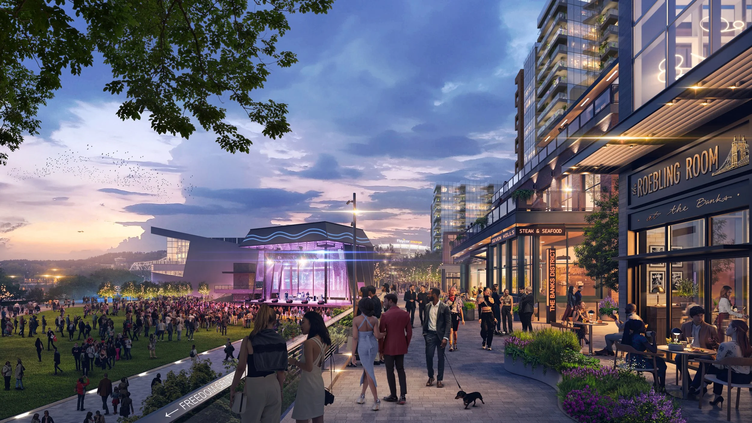
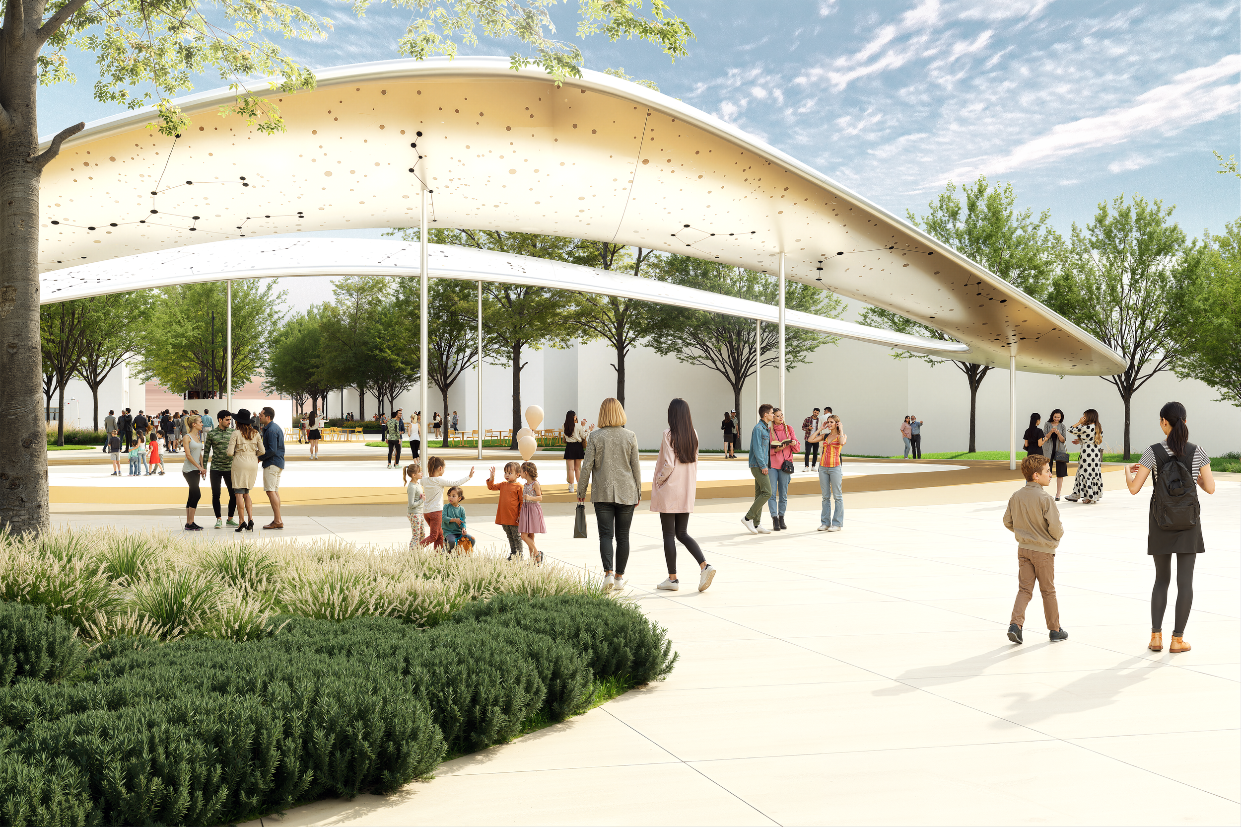
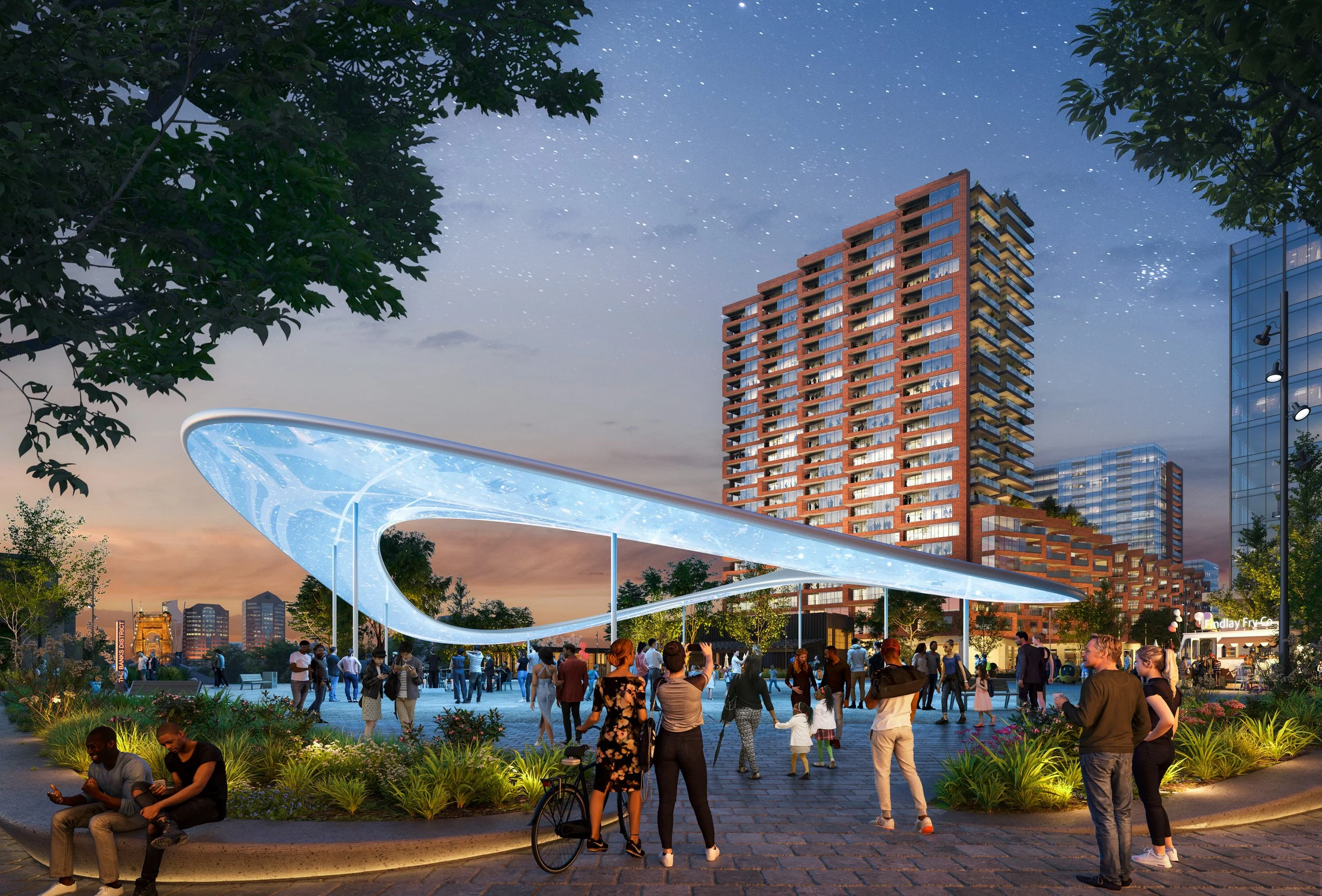
Central to the vision is a public realm framework where streets, plazas, parks, and pedestrian connections shape the experience of the district. Every planning and design decision prioritizes walkability, connectivity, and civic life, ensuring that public space serves as the foundation for future development. Key interventions include a landmark civic plaza that elevates the Freedom Center as the district's symbolic heart, a sculptural pedestrian bridge reconnecting the neighborhood to Smale Riverfront Park, and a flexible street network designed to accommodate both everyday neighborhood activity and major city events. Together, these investments create a district capable of functioning as both a vibrant neighborhood and a premier riverfront destination.
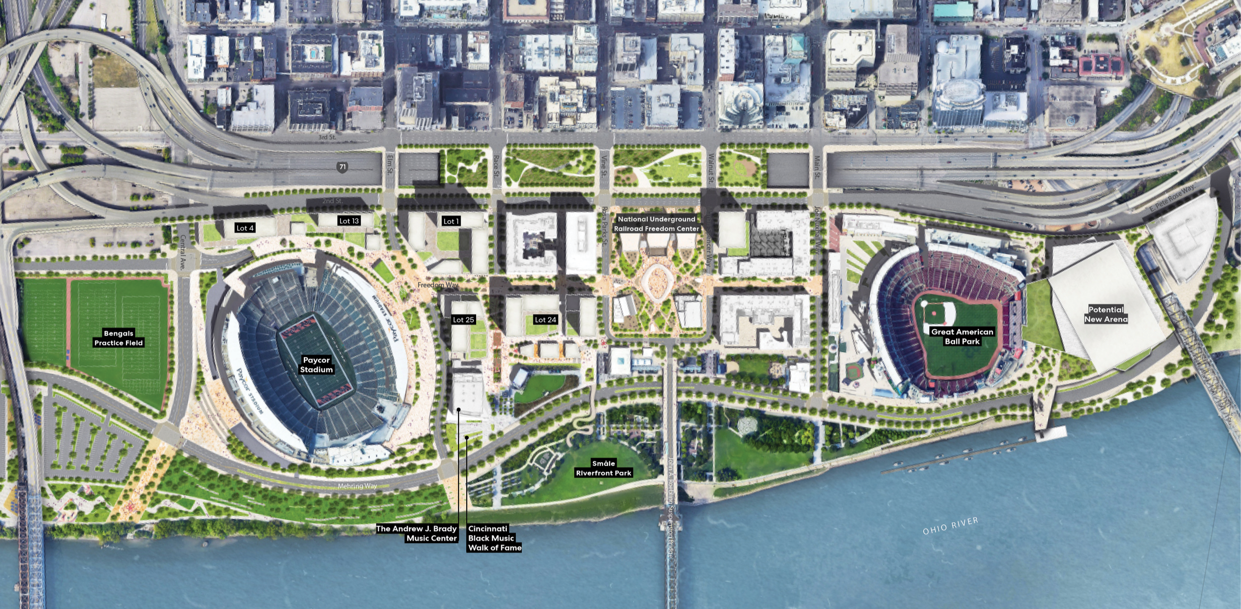
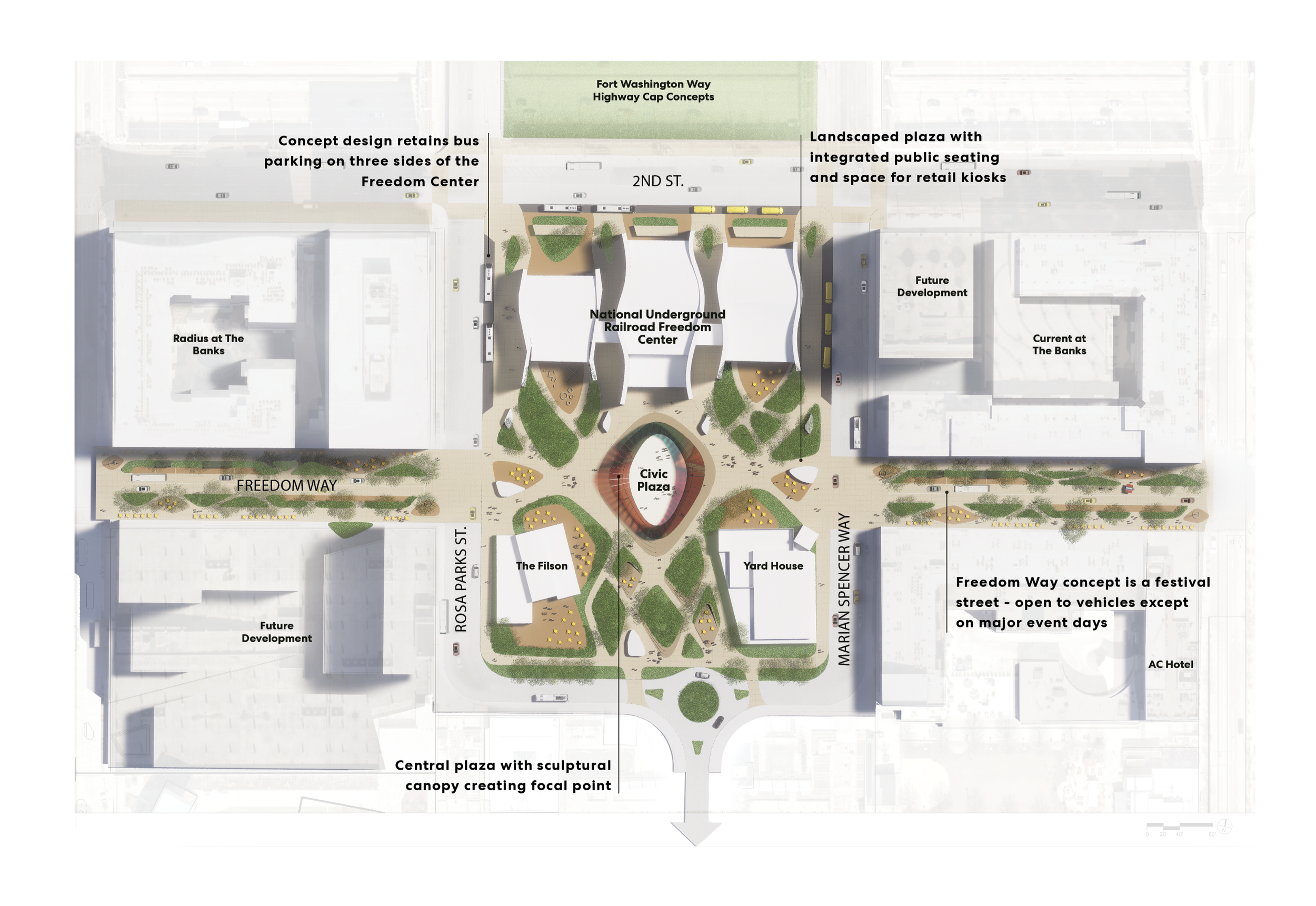
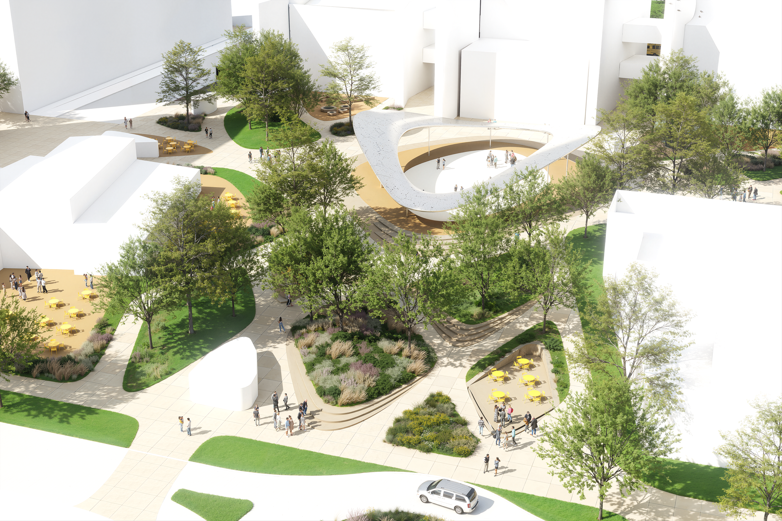
At the heart of the plan is a new civic plaza occupying one of the most symbolic, historically significant sites in Cincinnati. Situated between the National Underground Railroad Freedom Center and the Ohio River, the plaza exists within a landscape defined by civic landmarks. It sits beneath the Freedom’s Eternal Flame, a constant reminder of the struggle for liberty and human dignity. To the south, the historic John A. Roebling Suspension Bridge frames the river horizon, linking the city to more than a century of engineering, cultural, and natural history.
On Bengals Sundays, Reds Opening Day, and major city celebrations, the plaza must accommodate large crowds, fan traditions, and moments of shared civic pride. Yet on quieter days, it must offer places for reflection, gathering, and everyday use by providing shade, seating, clear access to the museum, and uninterrupted views toward the river and bridge.
The plaza is intentionally designed to be more than an extension of stadium infrastructure. It resists becoming a static ceremonial space, and instead, activates and anchors by supporting celebration without diminishing the significance of the institutions and stories that surround it. Through carefully considered materials, scale, and programming, the space becomes both threshold and destination—a civic stage capable of holding Cincinnati’s loudest cheers and its most reflective moments within the same public realm.
The Banks is a comprehensive urban framework that reimagines how Cincinnati engages with its waterfront. By reconnecting the city to the Ohio River, strengthening links between cultural institutions, parks, and entertainment venues, and introducing a more permanent residential population to downtown, the plan establishes a waterfront space that is active year-round and resilient for generations to come.